Planning Library Bookmobile Stops with PolicyMap
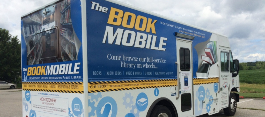
Libraries have long stood as vital community resources, providing free access to books, technology, and learning resources. One ever-present challenge libraries face is reaching underserved populations who may not have easy access to a physical library location. Bookmobiles, mobile libraries that travel to different places, have solved this problem since the first bookmobile in 1905 at the Washington County Public Library in Maryland. By bringing books, resources, and even Wi-Fi directly to people, libraries can foster a love of reading, promote literacy, and support lifelong learning in diverse communities. Modern libraries can strategically plan and optimize their bookmobile stops using PolicyMap data and maps.
Identifying Target Areas
One of the first steps in planning bookmobile stops is identifying which areas in the community need library services most. PolicyMap can help libraries analyze areas with low library access, high populations of children and elderly, or regions lacking educational resources. Libraries can overlay data such as income levels, public transportation routes, internet access, and school and community center locations to find optimal spots where bookmobile services would be most beneficial.
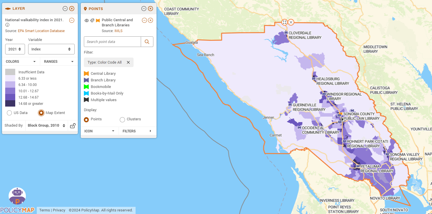
For example, libraries can overlay the EPA’s Walkability Index with their locations and branches to identify areas with low walkability scores. These areas might benefit from additional services, such as bookmobile stops, as residents may find it harder to reach library branches on foot.
Recalibrating map layers using the Map Extent feature helps plan bookmobile routes. Zooming in on a specific neighborhood, users can view detailed information about population density, school locations, bus routes, and pertinent socioeconomic data. If they zoom out to a county- or city-wide view, they see broader patterns and can identify underserved regions that need coverage. This recalibration ensures they always have the most relevant data, allowing for informed and efficient decision-making.
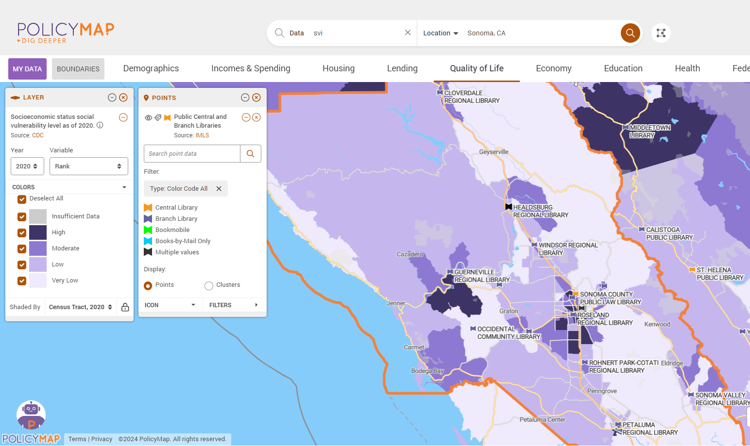
Using the CDC/ATSDR’s Social Vulnerability Index (SVI) in library services is a practical way to identify communities more likely to experience social vulnerability. By placing bookmobile stops in neighborhoods with high vulnerability scores, libraries can ensure that services are directed toward communities most in need of support at any time. The SVI, which measures the resilience of communities to external stresses like natural disasters and disease outbreaks, considers factors such as socioeconomic status, household composition, minority status, and housing type. This includes educational resources and community services, making it a relevant library tool.
Scheduling Stops Based on Community Needs
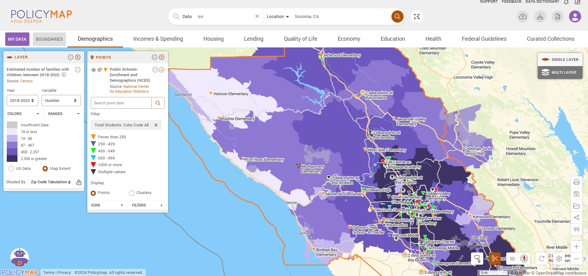
PolicyMap’s demographic and economic data layers can help libraries understand the best times to schedule stops. For example, areas with a high concentration of children might benefit from after-school hours visits, while communities with many elderly residents might prefer mid-morning stops. Libraries can use PolicyMap to analyze the daily rhythms of different neighborhoods and plan visits accordingly.
Regular bookmobile visits to areas near public schools can promote literacy and support educational goals. Libraries can coordinate with schools to align bookmobile offerings with curricula and literacy programs. Bookmobiles can fill in service gaps by identifying areas where families may not have easy access to a library branch, ensuring that all children can access library resources regardless of location.
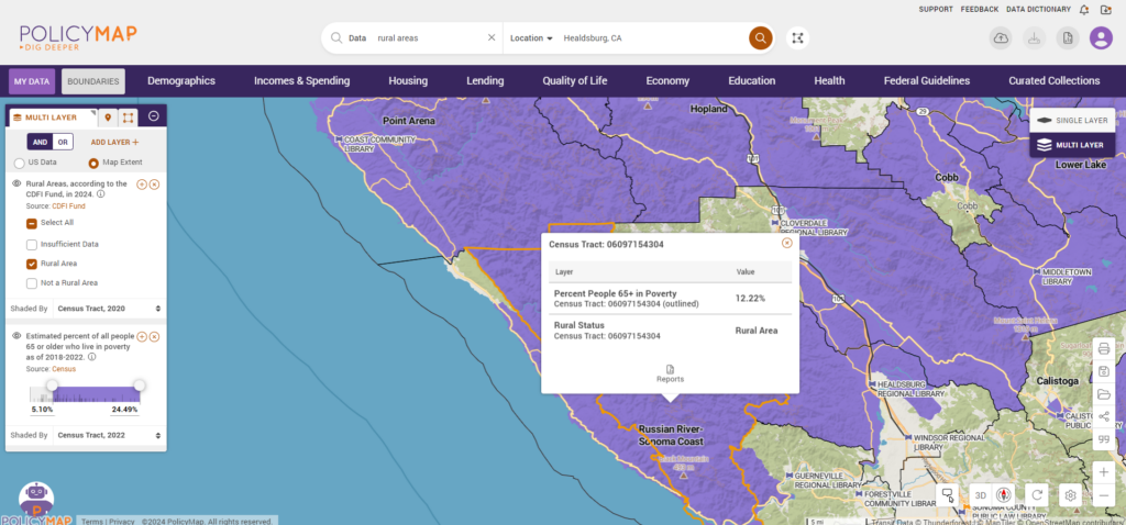
The Community Development Financial Institutions (CDFI) Fund provides geographic data on rural areas, which can be a valuable resource for librarians planning bookmobile access. This data can help identify rural communities and prioritize areas that would benefit the most from mobile library services. This map layers the Rural Areas, according to the CDFI Fund, in 2024, with the percentage of people 65 or older living in poverty along the Russian River-Sonoma Coast of California.
Evaluating and Adapting Strategies
The work continues after the planning. After the bookmobile routes are operational, libraries can use PolicyMap to evaluate the effectiveness of their stops. By tracking usage data—such as number of visitors, books checked out, and community feedback—libraries can assess which locations are performing well and which might need adjustments. PolicyMap’s data can help determine if shifts in demographics or community needs warrant changes in the bookmobile schedule or locations.
Supporting Grant Applications and Funding Requests
Finally, when libraries seek funding to support or expand their bookmobile services, PolicyMap can provide the data to support their proposals. Solid data can demonstrate the community’s needs and make a compelling case for the importance of mobile library services, helping to secure the necessary funding from donors, grants, or local governments.
Request More Information
For libraries looking to expand their reach and impact through bookmobile services, PolicyMap offers a valuable resource for making data-driven decisions that can enhance service delivery and community satisfaction. By leveraging PolicyMap’s comprehensive datasets and mapping capabilities, libraries can ensure their bookmobiles are on the move and on a mission to serve effectively. Through strategic planning and continuous assessment, libraries can turn their bookmobile programs into robust community engagement and enrichment tools.
Interested in learning more about how PolicyMap can elevate the offerings of public libraries for the betterment of their communities? Fill in the form below to learn more or schedule a demo.